
1951 Map of Yakutat
USGS Topo · Published 1952About this map
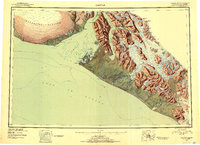
Yakutat stands as the primary outpost on this coastal survey, situated on Phipps Peninsula between the open waters of the Gulf of Alaska and the intricate inlets of Yakutat Bay. The landscape is dominated by the immense Malaspina Glacier to the west and the towering Saint Elias Mountains to the north and east. The mapping reveals a transition from the marine-focused activity at the Military Airport to the wilderness of the Tongass National Forest. Inland, the braided channels of the Dangerous River and Alsek River cut through the Brabazon Range, while numerous ice fields like the Artlewis Glacier and Nunatak Glacier feed into remote waters. This 1951 compilation provides a look at the region’s complex glaciology and its isolated maritime geography before extensive modern development.
Find a feature on this map
79 named features on this map. Tap any name to fly to it.
Don’t see what you’re looking for? This feature index may not catch every label — zoom into the map to look around manually.
Map Details
Editions of this 1951 Yakutat Map
4 editions found
Other maps of this area

1950 · Bering Glacier
USGS Topo · 1:250,000

1950 · Icy Bay
USGS Topo · 1:250,000

1951 · Icy Bay
USGS Topo · 1:250,000

1951 · Bering Glacier
USGS Topo · 1:250,000

1951 · Mt Saint Elias
USGS Topo · 1:250,000

1951 · Mt Fairweather
USGS Topo · 1:250,000

1952 · Skagway
USGS Topo · 1:250,000

1959 · Yakutat A-1
USGS Topo · 1:63,360

1959 · Yakutat C-3
USGS Topo · 1:63,360

1959 · Yakutat B-5
USGS Topo · 1:63,360