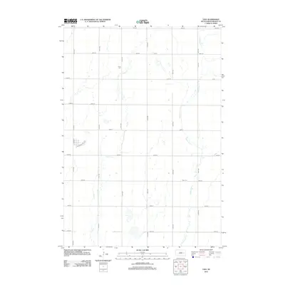
2012 Map of Yale
USGS Topo · Published 2012About this map
The agricultural plains of Beadle County are defined by a strict section-line road grid and the meandering paths of Pearl Cr and Middle Pearl Cr. This landscape near Yale is typical of the eastern South Dakota prairie, where life is organized around the intersection of long north-south avenues like 413th Ave and east-west streets. Historical continuity is anchored by local landmarks such as Trinity Cem in the north and Dixon Cem to the east. The presence of N Yale St and Railroad St reflects the traditional relationship between small prairie settlements and the transportation corridors that once moved grain and livestock across the region. Unlike more mountainous regions, the elevation here varies subtly, dictated by the gentle drainage basins of the local creeks.
Find a feature on this map
24 named features on this map. Tap any name to fly to it.
Don’t see what you’re looking for? This feature index may not catch every label — zoom into the map to look around manually.
Map Details
Editions of this 2012 Yale Map
This is the sole edition of this map. No revisions or reprints were ever made.
Other maps of this area

1895 · Byron
USGS Topo · 1:125,000

1898 · Huron
USGS Topo · 1:125,000

1899 · De Smet
USGS Topo · 1:125,000

1953 · Huron
USGS Topo · 1:250,000

1953 · Watertown
USGS Topo · 1:250,000

1954 · Huron
USGS Topo · 1:250,000

1956 · Lake Byron SE
USGS Topo · 1:24,000

1957 · Cavour
USGS Topo · 1:24,000

1958 · Watertown
USGS Topo · 1:250,000
1958 · Huron NE
USGS Topo · 1:24,000