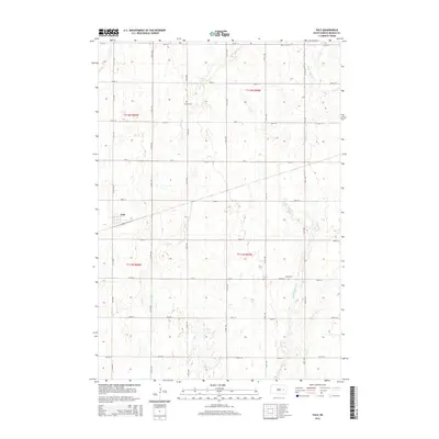
2015 Map of Yale
USGS Topo · Published 2015About this map
Yale anchors this rural Beadle County landscape, situated along the western edge of the quadrangle. The town sits at the intersection of local routes including 411th Ave and 203rd St, serving as a centralized point for the surrounding agricultural community. The terrain is defined by the subtle drainage of Pearl Creek and Middle Pearl Creek, which meander southward through a grid of section lines and county roads. Evidence of long-standing local heritage is preserved at Trinity Cem in the north and Dixon Cem to the southeast, providing valuable reference points for genealogists and local historians tracing families in the James River valley region. The layout reflects a deeply established township and range system, with infrastructure following rigid section boundaries typical of the South Dakota prairie.
Find a feature on this map
25 named features on this map. Tap any name to fly to it.
Don’t see what you’re looking for? This feature index may not catch every label — zoom into the map to look around manually.
Map Details
Editions of this 2015 Yale Map
This is the sole edition of this map. No revisions or reprints were ever made.
Other maps of this area

1895 · Byron
USGS Topo · 1:125,000

1898 · Huron
USGS Topo · 1:125,000

1899 · De Smet
USGS Topo · 1:125,000

1953 · Huron
USGS Topo · 1:250,000

1953 · Watertown
USGS Topo · 1:250,000

1954 · Huron
USGS Topo · 1:250,000

1956 · Lake Byron SE
USGS Topo · 1:24,000

1957 · Cavour
USGS Topo · 1:24,000

1958 · Watertown
USGS Topo · 1:250,000
1958 · Huron NE
USGS Topo · 1:24,000