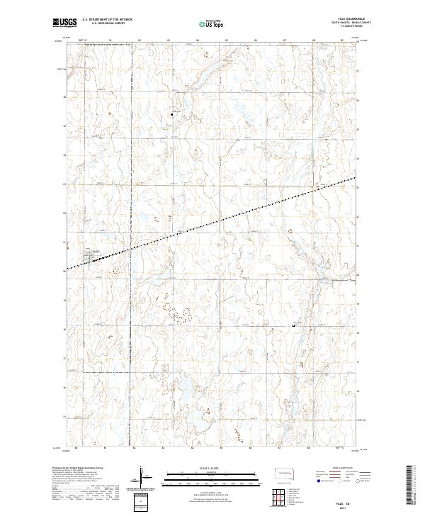
2021 Map of Yale
USGS Topo · Published 2021About this map
Yale anchors this rural landscape in Beadle County, where the town's grid of streets including Main St and 2nd St provides a rare concentrated settlement among the section lines of the South Dakota prairie. The landscape is defined by the winding paths of Pearl Cr and its tributary, Middle Pearl Cr, which cut through the agricultural blocks of t112n r60w and t112n r59w. For those researching family history in the region, two key sites are preserved: Trinity Cem located north of town near 200th St, and Dixon Cem to the southeast. The map reveals the rigid efficiency of the Public Land Survey System, with a nearly perfect grid of gravel roads such as 414th Ave and 204th St dividing the terrain into expansive sections.
Find a feature on this map
27 named features on this map. Tap any name to fly to it.
Don’t see what you’re looking for? This feature index may not catch every label — zoom into the map to look around manually.
Map Details
Editions of this 2021 Yale Map
This is the sole edition of this map. No revisions or reprints were ever made.
Other maps of this area

1895 · Byron
USGS Topo · 1:125,000

1898 · Huron
USGS Topo · 1:125,000

1899 · De Smet
USGS Topo · 1:125,000

1953 · Huron
USGS Topo · 1:250,000

1953 · Watertown
USGS Topo · 1:250,000

1954 · Huron
USGS Topo · 1:250,000

1956 · Lake Byron SE
USGS Topo · 1:24,000

1957 · Cavour
USGS Topo · 1:24,000

1958 · Watertown
USGS Topo · 1:250,000
1958 · Huron NE
USGS Topo · 1:24,000