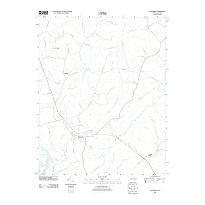
2010 Map of Yanceyville
USGS Topo · Published 2010About this map
Yanceyville serves as the central hub for this Caswell County landscape, where the town's street grid, including W Main St, contrasts with the surrounding agricultural and wooded terrain. The drainage of the region is defined by the winding paths of North Fork Rattlesnake Creek and South Fork Rattlesnake Creek, which converge as they flow through a territory marked by dispersed rural settlements. To the north, the community of Purley is situated along Old NC Highway 86 N, while Pleasant Grove anchors the southeastern corner. Historical transport and land use are evident in the network of named rural routes like Purley Church Rd and Hines Hatchett Rd, reflecting long-established property boundaries and local connectivity. The map also highlights smaller water bodies such as Moon Creek and Benaja Creek, providing a detailed look at the hydrology supporting the area's development into the early 21st century.
Find a feature on this map
56 named features on this map. Tap any name to fly to it.
Don’t see what you’re looking for? This feature index may not catch every label — zoom into the map to look around manually.
Map Details
Editions of this 2010 Yanceyville Map
This is the sole edition of this map. No revisions or reprints were ever made.
Other maps of this area

1923 · Danville
USGS Topo · 1:48,000

1925 · Danville
USGS Topo · 1:62,500

1952 · Milton
USGS Topo · 1:62,500

1953 · Greensboro
USGS Topo · 1:250,000

1954 · Greensboro
USGS Topo · 1:250,000

1956 · Milton
USGS Topo · 1:62,500

1962 · Greensboro
USGS Topo · 1:250,000

1965 · Danville
USGS Topo · 1:24,000

1965 · Ringgold
USGS Topo · 1:24,000

1966 · Greensboro
USGS Topo · 1:250,000