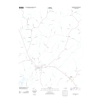
2013 Map of Yanceyville
USGS Topo · Published 2013About this map
Yanceyville serves as the central hub of this Caswell County landscape, where the town's grid meets a radial network of rural routes like Blanch Rd and Purley Church Rd. The geography is defined by the branching drainage of Rattlesnake Cr, including its N Fork and S Fork tributaries, which carve through the Piedmont terrain. To the north, the small settlement of Purley sits near Moon Cr, while Covington and Hamer anchor the western and eastern reaches. Farther south, Pleasant Grove marks a crossroads near Country Line Cr and its southern branch, S Country Line Cr. This contemporary survey illustrates a transition from concentrated town development to a dispersed rural pattern of family-named roads and agrarian settlements that have shaped the county for generations.
Find a feature on this map
84 named features on this map. Tap any name to fly to it.
Don’t see what you’re looking for? This feature index may not catch every label — zoom into the map to look around manually.
Map Details
Editions of this 2013 Yanceyville Map
This is the sole edition of this map. No revisions or reprints were ever made.
Other maps of this area

1923 · Danville
USGS Topo · 1:48,000

1925 · Danville
USGS Topo · 1:62,500

1952 · Milton
USGS Topo · 1:62,500

1953 · Greensboro
USGS Topo · 1:250,000

1954 · Greensboro
USGS Topo · 1:250,000

1956 · Milton
USGS Topo · 1:62,500

1962 · Greensboro
USGS Topo · 1:250,000

1965 · Danville
USGS Topo · 1:24,000

1965 · Ringgold
USGS Topo · 1:24,000

1966 · Greensboro
USGS Topo · 1:250,000