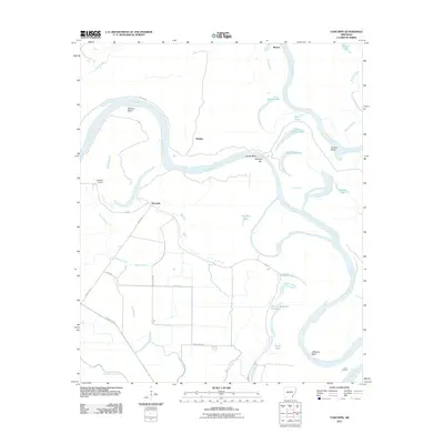
2011 Map of Yancopin
USGS Topo · Published 2011About this map
The Arkansas River and White River converge in this delta landscape, creating a complex network of oxbow lakes, sloughs, and bayous. Small riverfront settlements and landings like Yancopin, Medina, and Hopedale Landing are connected by a system of levees and rural roads such as Yancopin Rd and Medina Rd. The volatile nature of the river channels is evident in named features like Menard Bend, House Bend, and Melinda Bar, which document the shifting silt and water over time.
Find a feature on this map
37 named features on this map. Tap any name to fly to it.
Don’t see what you’re looking for? This feature index may not catch every label — zoom into the map to look around manually.
Map Details
Editions of this 2011 Yancopin Map
This is the sole edition of this map. No revisions or reprints were ever made.
Other maps of this area

1935 · Red Fork
USGS Topo · 1:62,500

1935 · Gillett
USGS Topo · 1:62,500

1939 · Henrico
USGS Topo · 1:62,500

1939 · Big Island
USGS Topo · 1:62,500

1948 · Helena
USGS Topo · 1:250,000

1950 · Helena
USGS Topo · 1:250,000

1953 · Greenwood
USGS Topo · 1:250,000

1954 · Henrico
USGS Topo · 1:62,500

1955 · Helena
USGS Topo · 1:250,000

1956 · Greenwood
USGS Topo · 1:250,000