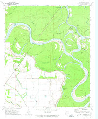
1972 Map of Yancopin
USGS Topo · Published 1974About this map
The confluence of the Arkansas River and White River dominates this early 1970s landscape in Desha County, where the rivers' shifting nature is visible in the complex network of oxbow lakes and cutoffs. The settlement of Yancopin sits along the Missouri Pacific railroad line, protected by a significant Levee system that skirts the low-lying wetlands. Much of the northern and eastern territory is preserved within the White River National Wildlife Refuge, a dense environment of bayous and ponds such as Bear Pond and Hog Pen Hole.
Find a feature on this map
41 named features on this map. Tap any name to fly to it.
Don’t see what you’re looking for? This feature index may not catch every label — zoom into the map to look around manually.
Map Details
Editions of this 1972 Yancopin Map
This is the sole edition of this map. No revisions or reprints were ever made.
Other maps of this area

1935 · Red Fork
USGS Topo · 1:62,500

1935 · Gillett
USGS Topo · 1:62,500

1939 · Henrico
USGS Topo · 1:62,500

1939 · Big Island
USGS Topo · 1:62,500

1948 · Helena
USGS Topo · 1:250,000

1950 · Helena
USGS Topo · 1:250,000

1953 · Greenwood
USGS Topo · 1:250,000

1954 · Henrico
USGS Topo · 1:62,500

1955 · Helena
USGS Topo · 1:250,000

1956 · Greenwood
USGS Topo · 1:250,000