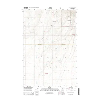
2014 Map of Yaple Bench
USGS Topo · Published 2014About this map
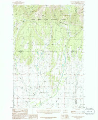
Yaple Bench defines the central topography of this landscape on the border of Fergus and Wheatland counties. The northern portion of the map is dominated by the Lewis & Clark National Forest, where the terrain rises toward distinctive landmarks like Castle Rocks and the headwaters of Ross Fork Cr. The map reveals a high-plains environment deeply etched by drainage systems including Porcupine Gulch and Browns Gulch. This 2014 survey illustrates the persistence of a rural road network that follows the natural contours of the benchland and creek bottoms. Early ranching and transit routes are reflected in the naming of roads such as Yaple Bench Rd, Garneill Rd, and Timber Creek Rd. The complex drainage pattern of W Fork Blake Cr and E Fork Blake Cr demonstrates how seasonal water sources have historically dictated the placement of boundary lines and access roads in this part of Montana.
Find a feature on this map
29 named features on this map. Tap any name to fly to it.
Don’t see what you’re looking for? This feature index may not catch every label — zoom into the map to look around manually.
Map Details
Editions of this 2014 Yaple Bench Map
This is the sole edition of this map. No revisions or reprints were ever made.
Other maps of this area

1889 · Big Snowy Mountain
USGS Topo · 1:250,000

1893 · Big Snowy Mountain
USGS Topo · 1:250,000

1954 · Roundup
USGS Topo · 1:250,000

1958 · Roundup
USGS Topo · 1:250,000

1970 · Crystal Lake
USGS Topo · 1:24,000
1970 · Moore SW
USGS Topo · 1:24,000
1970 · Jump Off Peak
USGS Topo · 1:24,000
1986 · Yaple Bench
USGS Topo · 1:24,000
1986 · Snow Saucer Coulee
USGS Topo · 1:24,000

1986 · Halbert Creek North
USGS Topo · 1:24,000