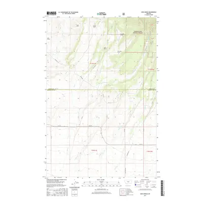
2017 Map of Yaple Bench
USGS Topo · Published 2017About this map
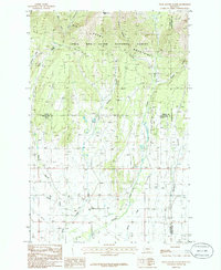
Lewis & Clark National Forest encompasses the northeastern portion of this Montana landscape, where the terrain shifts through a series of drainages and high points. The namesake Yaple Bench sits centrally, surrounded by deep-cut features such as Porcupine Gulch and Tie Camp Coulee. This high-plains topography is defined by its water system, with Ross Fork Cr and Niel Cr flowing through the northern sections while Galloway Cr and Timber Cr drain the southern reaches. The border between Fergus and Wheatland counties bisects the map, illustrating how early political boundaries were laid across these remote ranching and grazing lands. Prominent landmarks like Castle Rocks and Mills Coulee provide distinct orientation points in a territory historically navigated by local roads such as Garnell Rd and Co Rd 297.
Find a feature on this map
28 named features on this map. Tap any name to fly to it.
Don’t see what you’re looking for? This feature index may not catch every label — zoom into the map to look around manually.
Map Details
Editions of this 2017 Yaple Bench Map
This is the sole edition of this map. No revisions or reprints were ever made.
Other maps of this area

1889 · Big Snowy Mountain
USGS Topo · 1:250,000

1893 · Big Snowy Mountain
USGS Topo · 1:250,000

1954 · Roundup
USGS Topo · 1:250,000

1958 · Roundup
USGS Topo · 1:250,000

1970 · Crystal Lake
USGS Topo · 1:24,000
1970 · Moore SW
USGS Topo · 1:24,000
1970 · Jump Off Peak
USGS Topo · 1:24,000
1986 · Yaple Bench
USGS Topo · 1:24,000
1986 · Snow Saucer Coulee
USGS Topo · 1:24,000

1986 · Halbert Creek North
USGS Topo · 1:24,000