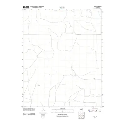
2010 Map of Yates
USGS Topo · Published 2010About this map
Yates anchors this high plains landscape in Harding County, where the road network reflects the sparse but intentional ranching and agricultural settlement of northeastern New Mexico. The terrain is marked by prominent elevations such as Cerro de la Cruz and the drainage of Ute Creek, which carves through the eastern portion of the quadrangle. A system of secondary routes, including County Rd C001 and County Road Z-3, connects isolated points like Martinez to the larger region. This 2010 survey illustrates the enduring rural character of the area, where land use is dictated by the availability of water and the orientation of the high mesas. The map provides a clear record of property access and rural infrastructure in a corner of the state where large-scale development remains absent.
Find a feature on this map
11 named features on this map. Tap any name to fly to it.
Don’t see what you’re looking for? This feature index may not catch every label — zoom into the map to look around manually.
Map Details
Editions of this 2010 Yates Map
This is the sole edition of this map. No revisions or reprints were ever made.
Other maps of this area

1954 · Raton
USGS Topo · 1:250,000

1954 · Dalhart
USGS Topo · 1:250,000

1958 · Raton
USGS Topo · 1:250,000

1958 · Dalhart
USGS Topo · 1:250,000

1962 · Dalhart
USGS Topo · 1:250,000

1973 · Yates SE
USGS Topo · 1:24,000

1973 · Romero Spring
USGS Topo · 1:24,000
1973 · Valencia Spring
USGS Topo · 1:24,000
1974 · Kansas Valley
USGS Topo · 1:24,000

1974 · Farley
USGS Topo · 1:24,000