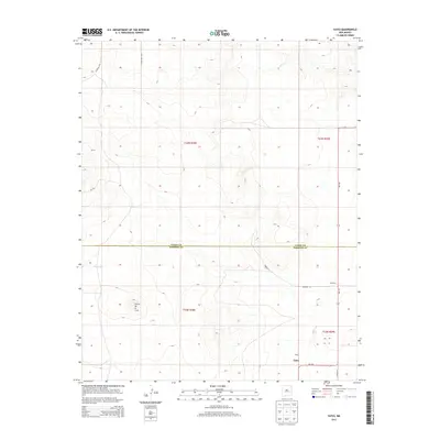
2013 Map of Yates
USGS Topo · Published 2013About this map
Cerro de la Cruz rises as a prominent landmark in this high plains landscape of Northeastern New Mexico, where the boundary between Union County and Harding County cuts directly across the terrain. The small community of Yates serves as a focal point along NM-120, which connects the region's isolated settlements. This 2013 survey illustrates a sparsely populated ranching or agricultural environment characterized by a network of county roads like CO Road Z-2 and CO Road Z-3 that navigate the varied topography.
Find a feature on this map
14 named features on this map. Tap any name to fly to it.
Don’t see what you’re looking for? This feature index may not catch every label — zoom into the map to look around manually.
Map Details
Editions of this 2013 Yates Map
This is the sole edition of this map. No revisions or reprints were ever made.
Other maps of this area

1954 · Raton
USGS Topo · 1:250,000

1954 · Dalhart
USGS Topo · 1:250,000

1958 · Raton
USGS Topo · 1:250,000

1958 · Dalhart
USGS Topo · 1:250,000

1962 · Dalhart
USGS Topo · 1:250,000

1973 · Yates SE
USGS Topo · 1:24,000

1973 · Romero Spring
USGS Topo · 1:24,000
1973 · Valencia Spring
USGS Topo · 1:24,000
1974 · Kansas Valley
USGS Topo · 1:24,000

1974 · Farley
USGS Topo · 1:24,000