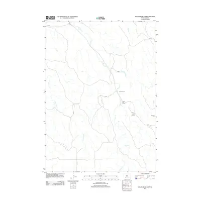
2012 Map of Yellow Bear Camp
USGS Topo · Published 2012About this map
Yellow Bear Camp serves as a central landmark in this Oglala Lakota landscape, where the geography is defined by the winding paths of No Flesh Cr and Medicine Root Cr. The area is characterized by a sparse network of roads, including Allen Rd and BIA Rd 4, which connect scattered residential and community sites across the plains. Local history is anchored at Body of Christ Cem and Pleasant Hill Cem, located near the intersection of Cedar Ln and the primary road network. The terrain is marked by the distinct Yellow Bear Canyon, illustrating the erosional patterns common to this part of the northern Great Plains. This 2012 survey provides a clear look at the contemporary infrastructure of the Pine Ridge region, showing how modern names and traditional land use intersect.
Find a feature on this map
16 named features on this map. Tap any name to fly to it.
Don’t see what you’re looking for? This feature index may not catch every label — zoom into the map to look around manually.
Map Details
Editions of this 2012 Yellow Bear Camp Map
This is the sole edition of this map. No revisions or reprints were ever made.
Other maps of this area

1955 · Hot Springs
USGS Topo · 1:250,000

1955 · Martin
USGS Topo · 1:250,000

1958 · Martin
USGS Topo · 1:250,000

1981 · Yellow Bear Camp
USGS Topo · 1:25,000

1981 · Allen
USGS Topo · 1:25,000

1981 · Kyle
USGS Topo · 1:25,000
1981 · Batesland
USGS Topo · 1:25,000

1981 · Hisle
USGS Topo · 1:25,000

1981 · Swett
USGS Topo · 1:25,000

1983 · Martin
USGS Topo · 1:100,000