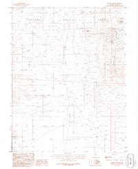
1986 Map of Yellow Cone
USGS Topo · Published 1986About this map
Toiyabe National Forest lands dominate this high-elevation terrain in Nye County, where the topography transitions into the steep slopes of the Monitor Range. This 1980s survey captures a landscape defined by significant relief and ephemeral drainage patterns, most notably Saulsbury Wash, which cuts through the central portion of the quadrangle. A solitary Well is noted near the wash, indicating the importance of groundwater in this arid environment.
Find a feature on this map
9 named features on this map. Tap any name to fly to it.
Don’t see what you’re looking for? This feature index may not catch every label — zoom into the map to look around manually.
Map Details
Editions of this 1986 Yellow Cone Map
This is the sole edition of this map. No revisions or reprints were ever made.
Other maps of this area

1908 · Kawich
USGS Topo · 1:250,000

1942 · Cactus Range
USGS Topo · 1:125,000

1952 · Stinking Spring
USGS Topo · 1:62,500

1952 · Cactus Peak
USGS Topo · 1:62,500

1954 · Goldfield
USGS Topo · 1:250,000

1955 · Goldfield
USGS Topo · 1:250,000

1956 · Tonopah
USGS Topo · 1:250,000

1958 · Goldfield
USGS Topo · 1:250,000

1959 · Tonopah
USGS Topo · 1:250,000

1962 · Goldfield
USGS Topo · 1:250,000