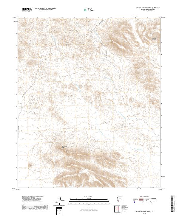
2021 Map of Yellow Medicine Butte
USGS Topo · Published 2021About this map
The Sundad settlement area sits within a high desert landscape dominated by the southern reaches of the Gila Bend Mountains. This 2021 survey details a region defined by dramatic vertical relief and complex drainage systems. Prominent peaks including Yellow Medicine Butte, Face Mtn, and the distinctive Montezuma Head serve as primary navigational landmarks across the arid terrain. The hydrologic network is dictated by the broad paths of Yellow Medicine Wash and Loudermilk Wash, which channel seasonal runoff from the surrounding slopes. Transportation through this remote section of Maricopa County is centered on Agua Caliente Rd, which skirts the western edge of the mountainous interior, providing access to the isolated outpost of Sundad.
Find a feature on this map
14 named features on this map. Tap any name to fly to it.
Don’t see what you’re looking for? This feature index may not catch every label — zoom into the map to look around manually.
Map Details
Editions of this 2021 Yellow Medicine Butte Map
This is the sole edition of this map. No revisions or reprints were ever made.
Other maps of this area

1927 · Hyder
USGS Topo · 1:62,500

1930 · Hyder
USGS Topo · 1:62,500

1942 · Vicksburg
USGS Topo · 1:250,000

1951 · Dendora Valley
USGS Topo · 1:62,500

1954 · Phoenix
USGS Topo · 1:250,000

1957 · Phoenix
USGS Topo · 1:250,000

1958 · Phoenix
USGS Topo · 1:250,000

1960 · Phoenix
USGS Topo · 1:250,000

1962 · Cortez Peak
USGS Topo · 1:62,500

1962 · Eagletail Mts
USGS Topo · 1:62,500