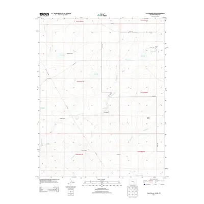
2013 Map of Yellowbank Creek
USGS Topo · Published 2013About this map
Mustang Ranch and the small settlement of Yellowbank anchor this portion of Pueblo County, where the high plains landscape is defined by its water management. The geography centers on the seasonal drainages of Mustang Cr, Yellowbank Cr, and Powell Arroyo, which support a network of ranching infrastructure. Named reservoirs like Stauder Reservoir and Altman Reservoir dot the terrain, while landmarks such as the Weinegar Windmill, Derringer Windmill, and Altman Windmill highlight the essential reliance on groundwater in this arid environment. Significant depressions and draws, such as Hardesty Draw and the Big Pit, reveal the underlying geology and land use patterns of the early 21st century. The map also traces local transport routes including Flying A Rd and Red Top Rd, which connect these isolated ranching outposts.
Find a feature on this map
29 named features on this map. Tap any name to fly to it.
Don’t see what you’re looking for? This feature index may not catch every label — zoom into the map to look around manually.
Map Details
Editions of this 2013 Yellowbank Creek Map
This is the sole edition of this map. No revisions or reprints were ever made.
Other maps of this area

1891 · Nepesta
USGS Topo · 1:125,000

1891 · Apishapa
USGS Topo · 1:125,000

1893 · Nepesta
USGS Topo · 1:125,000

1893 · Apishapa
USGS Topo · 1:125,000

1897 · Apishapa
USGS Topo · 1:125,000

1904 · Nepesta
USGS Topo · 1:125,000

1954 · Trinidad
USGS Topo · 1:250,000

1954 · Pueblo
USGS Topo · 1:250,000

1955 · Trinidad
USGS Topo · 1:250,000

1957 · Pueblo
USGS Topo · 1:250,000