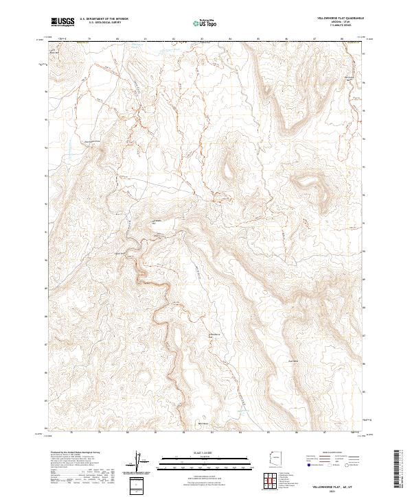
2021 Map of Yellowhorse Flat
USGS Topo · Published 2021About this map
Yellowhorse Flat characterizes this arid corner of Mohave County, where the Arizona and Utah border meets amidst a complex network of seasonal drainages and primitive routes. The landscape is defined by its dramatic relief, including the prominent East Mesa and West Mesa to the south and the high ground of Joe Blake Hill and Little Black Mtn to the north. Water management in this high desert environment is evidenced by the solitary Blake Pond, while the natural drainage system is carved by Fort Pearce Wash, Dutchman Draw, and Hurricane Wash.
Find a feature on this map
56 named features on this map. Tap any name to fly to it.
Don’t see what you’re looking for? This feature index may not catch every label — zoom into the map to look around manually.
Map Details
Editions of this 2021 Yellowhorse Flat Map
This is the sole edition of this map. No revisions or reprints were ever made.
Other maps of this area

1885 · St. George
USGS Topo · 1:250,000

1886 · Mt. Trumbull
USGS Topo · 1:250,000

1891 · St. George
USGS Topo · 1:250,000

1892 · Mt. Trumbull
USGS Topo · 1:250,000

1953 · Cedar City
USGS Topo · 1:250,000

1953 · Grand Canyon
USGS Topo · 1:250,000

1954 · Hurricane Cliffs 2 NW
USGS Topo · 1:24,000

1954 · Hurricane Cliffs 2 NE
USGS Topo · 1:24,000

1954 · La Verkin 3 SE
USGS Topo · 1:24,000

1954 · La Verkin 3 SW
USGS Topo · 1:24,000