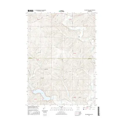
2016 Map of Yellowstone Lake
USGS Topo · Published 2016About this map
Yellowstone Lake and its surrounding watershed define the topography of this southern Wisconsin borderland where Iowa and Lafayette counties meet. The small settlement of Yellowstone sits tucked into the hills above the Yellowstone River, which winds its way toward the larger E Br Pecatonica River. The area is characterized by deep valleys like Glenn Valley and Star Valley, as well as distinctive geographic features like the Horseshoe Bend loop. Genealogical interest is centered on several scattered burial grounds, including Yellowstone Lutheran Cem and Saint Michaels Catholic Cem. This 2016 survey documents the rural character of the Driftless Area, where a complex network of local roads such as Durkin Rd and Atkinson Rd trace the ridgelines and creek bottoms of the English Hollow landscape.
Find a feature on this map
74 named features on this map. Tap any name to fly to it.
Don’t see what you’re looking for? This feature index may not catch every label — zoom into the map to look around manually.
Map Details
Editions of this 2016 Yellowstone Lake Map
This is the sole edition of this map. No revisions or reprints were ever made.
Other maps of this area

1902 · Mineral Point
USGS Topo · 1:125,000

1923 · Blanchardville
USGS Topo · 1:62,500

1923 · South Wayne
USGS Topo · 1:62,500

1954 · Rockford
USGS Topo · 1:250,000

1955 · Rockford
USGS Topo · 1:250,000

1958 · Rockford
USGS Topo · 1:250,000

1959 · Dubuque
USGS Topo · 1:250,000

1961 · Dubuque
USGS Topo · 1:250,000

1962 · Dubuque
USGS Topo · 1:250,000
1962 · Blanchardville
USGS Topo · 1:62,500