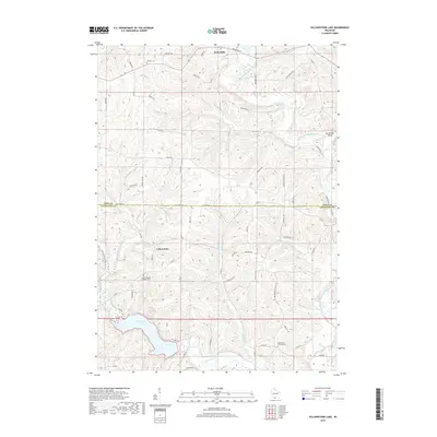
2018 Map of Yellowstone Lake
USGS Topo · Published 2018About this map
Hollandale sits at the northern edge of this Driftless Area landscape, where the East Branch Pecatonica River and its tributaries carve through the limestone-rich terrain of southern Wisconsin. The map captures a primarily agricultural region defined by the drainage patterns of Olson Cr, Schmidt Cr, and McClintock Cr, all leading toward the prominent Yellowstone Lake. This reservoir and its surrounding recreation area serve as a focal point for the small settlement of Yellowstone.
Find a feature on this map
68 named features on this map. Tap any name to fly to it.
Don’t see what you’re looking for? This feature index may not catch every label — zoom into the map to look around manually.
Map Details
Editions of this 2018 Yellowstone Lake Map
This is the sole edition of this map. No revisions or reprints were ever made.
Other maps of this area

1902 · Mineral Point
USGS Topo · 1:125,000

1923 · Blanchardville
USGS Topo · 1:62,500

1923 · South Wayne
USGS Topo · 1:62,500

1954 · Rockford
USGS Topo · 1:250,000

1955 · Rockford
USGS Topo · 1:250,000

1958 · Rockford
USGS Topo · 1:250,000

1959 · Dubuque
USGS Topo · 1:250,000

1961 · Dubuque
USGS Topo · 1:250,000

1962 · Dubuque
USGS Topo · 1:250,000
1962 · Blanchardville
USGS Topo · 1:62,500