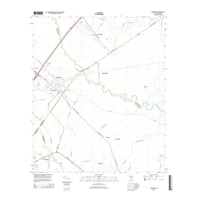
2014 Map of Yemassee
USGS Topo · Published 2014About this map
The Lowcountry landscape of South Carolina is defined here by the winding course of the Combahee River and the Pocotaligo River, which snake through the coastal plains. At the heart of this crossroads lies Yemassee, where the convergence of rail and road networks remains a vital regional node. The map documents a complex web of small settlements and historical land tracts, including Tomotley, Brewton, and Rose Hill, reflecting a pattern of habitation that has persisted for generations.
Find a feature on this map
71 named features on this map. Tap any name to fly to it.
Don’t see what you’re looking for? This feature index may not catch every label — zoom into the map to look around manually.
Map Details
Editions of this 2014 Yemassee Map
This is the sole edition of this map. No revisions or reprints were ever made.
Other maps of this area

1918 · Walterboro
USGS Topo · 1:62,500

1918 · Green Pond
USGS Topo · 1:62,500

1918 · Yemassee
USGS Topo · 1:62,500

1919 · Cummings
USGS Topo · 1:62,500

1943 · Yemassee
USGS Topo · 1:62,500

1943 · Green Pond
USGS Topo · 1:62,500

1943 · Cummings
USGS Topo · 1:62,500

1943 · Walterboro
USGS Topo · 1:62,500

1947 · Savannah
USGS Topo · 1:250,000

1948 · Savannah
USGS Topo · 1:250,000