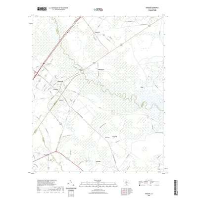
2020 Map of Yemassee
USGS Topo · Published 2020About this map
Yemassee serves as a critical nexus where Hampton, Beaufort, Jasper, and Colleton counties converge, defined by its historic position along major rail and road corridors. The landscape is dominated by the sprawling wetlands of the Combahee River and the Pocotaligo River, which historically dictated the patterns of settlement and agriculture in this Lowcountry region. Smaller communities like Pocotaligo, Tomotley, and Blountville are interspersed throughout the river basins, often associated with historic estates and plantations such as Rose Hill and Brewton. The presence of the Salkehatchie Cem near the Salkehatchie settlement highlights the deep local roots of these communities. Large-scale hydrographic features like Gregorie Pond and the winding river channels illustrate the watery nature of the terrain, which continues to shape the infrastructure and character of the town and its outlying rural districts.
Find a feature on this map
71 named features on this map. Tap any name to fly to it.
Don’t see what you’re looking for? This feature index may not catch every label — zoom into the map to look around manually.
Map Details
Editions of this 2020 Yemassee Map
This is the sole edition of this map. No revisions or reprints were ever made.
Other maps of this area

1918 · Walterboro
USGS Topo · 1:62,500

1918 · Green Pond
USGS Topo · 1:62,500

1918 · Yemassee
USGS Topo · 1:62,500

1919 · Cummings
USGS Topo · 1:62,500

1943 · Yemassee
USGS Topo · 1:62,500

1943 · Green Pond
USGS Topo · 1:62,500

1943 · Cummings
USGS Topo · 1:62,500

1943 · Walterboro
USGS Topo · 1:62,500

1947 · Savannah
USGS Topo · 1:250,000

1948 · Savannah
USGS Topo · 1:250,000