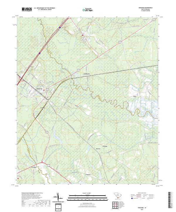
2024 Map of Yemassee
USGS Topo · Published 2024About this map
The Combahee River and Pocotaligo River define the lowcountry landscape of this coastal South Carolina corridor, where the boundaries of Beaufort, Hampton, Colleton, and Jasper counties converge. The town of Yemassee serves as a central hub, flanked by smaller historic settlements such as Blountville and Salkehatchie. This modern documentation highlights the extensive protected lands of the Ernest F Hollings Ace Basin National Wildlife Refuge, which preserves the wetlands and river bottoms that have historically shaped local industry and transit.
Find a feature on this map
70 named features on this map. Tap any name to fly to it.
Don’t see what you’re looking for? This feature index may not catch every label — zoom into the map to look around manually.
Map Details
Editions of this 2024 Yemassee Map
This is the sole edition of this map. No revisions or reprints were ever made.
Other maps of this area

1918 · Walterboro
USGS Topo · 1:62,500

1918 · Green Pond
USGS Topo · 1:62,500

1918 · Yemassee
USGS Topo · 1:62,500

1919 · Cummings
USGS Topo · 1:62,500

1943 · Yemassee
USGS Topo · 1:62,500

1943 · Green Pond
USGS Topo · 1:62,500

1943 · Cummings
USGS Topo · 1:62,500

1943 · Walterboro
USGS Topo · 1:62,500

1947 · Savannah
USGS Topo · 1:250,000

1948 · Savannah
USGS Topo · 1:250,000