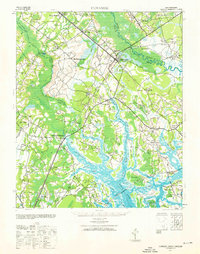
1943 Map of Yemassee
USGS Topo · Published 1960About this map
Yemassee serves as a critical railroad junction in the Lowcountry, where the Atlantic Coast Line intersects with the Charleston and Western Carolina. This coastal South Carolina landscape is defined by its complex tidal networks, including the Coosawhatchie River and Combahee River, which feed into expansive tracts of salt marsh. The map reveals a pattern of rural settlement concentrated along historical overland routes like the Augusta Road and the Mt Nevo Road.
Find a feature on this map
59 named features on this map. Tap any name to fly to it.
Don’t see what you’re looking for? This feature index may not catch every label — zoom into the map to look around manually.
Map Details
Editions of this 1943 Yemassee Map
3 editions found

Other maps of this area

1918 · Walterboro
USGS Topo · 1:62,500

1918 · Green Pond
USGS Topo · 1:62,500

1918 · Varnville
USGS Topo · 1:62,500

1918 · Yemassee
USGS Topo · 1:62,500

1919 · Pineland
USGS Topo · 1:62,500

1919 · Cummings
USGS Topo · 1:62,500

1920 · Hardeeville
USGS Topo · 1:62,500

1920 · Okatie
USGS Topo · 1:62,500

1942 · Okatie
USGS Topo · 1:62,500

1943 · Pineland
USGS Topo · 1:62,500