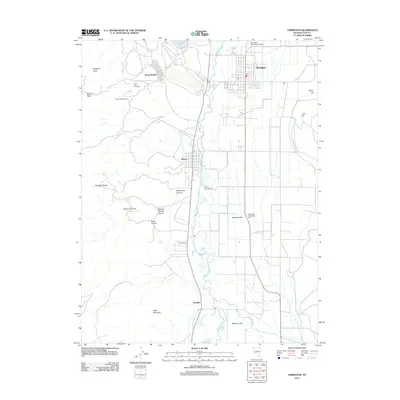
2012 Map of Yerington
USGS Topo · Published 2012About this map
Yerington and the surrounding agricultural valley are captured in this 2012 survey, revealing the complex water systems of the Walker River as it splits into East and West forks. The map illustrates the distinct layout of the community of Weed Heights overlooking the valley floor, while the smaller settlement of Mason sits nestled near the river's path. This region of Lyon County is defined by the sharp transition from the irrigated fields of Mason Valley to the arid slopes of the Singatse Range and Singatse Peak. Local infrastructure and social centers are documented throughout, including the Yerington Municipal Airport and the South End Community Hall. The geography highlights how historical ranching sites like Bee Ranch and early nodes like Nordyke were strategically placed along the water's edge below Black Mountain.
Find a feature on this map
26 named features on this map. Tap any name to fly to it.
Don’t see what you’re looking for? This feature index may not catch every label — zoom into the map to look around manually.
Map Details
Editions of this 2012 Yerington Map
This is the sole edition of this map. No revisions or reprints were ever made.
Other maps of this area

1891 · Wabuska
USGS Topo · 1:125,000

1891 · Wellington
USGS Topo · 1:125,000

1893 · Wellington
USGS Topo · 1:125,000

1894 · Wabuska
USGS Topo · 1:125,000

1948 · Walker Lake
USGS Topo · 1:250,000

1957 · Walker Lake
USGS Topo · 1:250,000

1957 · Wellington
USGS Topo · 1:62,500

1957 · Como
USGS Topo · 1:62,500

1957 · Wabuska
USGS Topo · 1:62,500

1957 · Yerington
USGS Topo · 1:62,500