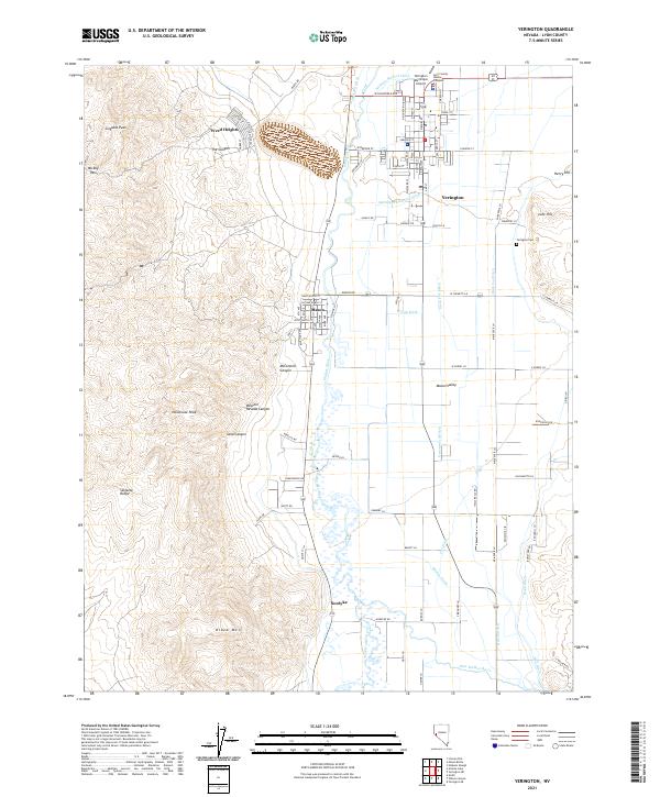
2021 Map of Yerington
USGS Topo · Published 2021About this map
Mason Valley serves as the focal point of this Nevada landscape, where the confluence of the West Walker River and East Walker River creates a fertile agricultural corridor bounded by the high peaks of the Singatse Range. The settlement patterns here are defined by water management, with an intricate network of irrigation channels including the Main Fox Ditch, Greenwood Ditch, and Spragg-Woodcock Ditch supporting the valley floor. The town of Yerington sits as the central hub, supported by the outlying communities of Weed Heights, Mason, and Nordyke. To the west, the terrain rises sharply toward Singatse Peak and Newhouse Peak, cut by deep drainages like McConnell Canyon and Western Nevada Canyon. This survey captures the modern layout of the region, including the Yerington Municipal Airport and the Lyon County Justice Complex, while preserving the locations of legacy sites like the Yerington Cem.
Find a feature on this map
59 named features on this map. Tap any name to fly to it.
Don’t see what you’re looking for? This feature index may not catch every label — zoom into the map to look around manually.
Map Details
Editions of this 2021 Yerington Map
This is the sole edition of this map. No revisions or reprints were ever made.
Other maps of this area

1891 · Wabuska
USGS Topo · 1:125,000

1891 · Wellington
USGS Topo · 1:125,000

1893 · Wellington
USGS Topo · 1:125,000

1894 · Wabuska
USGS Topo · 1:125,000

1948 · Walker Lake
USGS Topo · 1:250,000

1957 · Walker Lake
USGS Topo · 1:250,000

1957 · Wellington
USGS Topo · 1:62,500

1957 · Como
USGS Topo · 1:62,500

1957 · Wabuska
USGS Topo · 1:62,500

1957 · Yerington
USGS Topo · 1:62,500