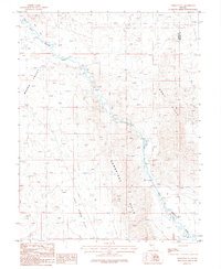
1986 Map of Yerington SE
USGS Topo · Published 1987About this map
The East Walker River snakes through the high desert of western Nevada, defining a landscape shaped by hydrology and mineral extraction in the mid-1980s. This survey captures the transition from the irrigated agricultural grounds of the Mason Valley in the northwest to the arid, elevated terrain of the Cambridge Hills and Gray Hills. In the northeast corner, a cluster of prospects, mine shafts, and adits suggests the area's legacy of prospecting, concentrated near the border of Lyon and Mineral counties. The river's path is monitored at a gaging station, highlighting the importance of water management in this environment. To the south, the terrain levels out into the broad Pine Grove Flat, while the presence of a Gravel Pit near the river indicates contemporary resource use alongside older mining works.
Find a feature on this map
15 named features on this map. Tap any name to fly to it.
Don’t see what you’re looking for? This feature index may not catch every label — zoom into the map to look around manually.
Map Details
Editions of this 1986 Yerington SE Map
This is the sole edition of this map. No revisions or reprints were ever made.
Other maps of this area

1891 · Wellington
USGS Topo · 1:125,000

1893 · Wellington
USGS Topo · 1:125,000

1909 · Hawthorne
USGS Topo · 1:250,000

1911 · Hawthorne
USGS Topo · 1:250,000

1915 · Hawthorne
USGS Topo · 1:250,000

1948 · Walker Lake
USGS Topo · 1:250,000

1956 · Mt. Grant
USGS Topo · 1:62,500

1957 · Walker Lake
USGS Topo · 1:250,000

1957 · Yerington
USGS Topo · 1:62,500

1958 · Pine Grove Hills
USGS Topo · 1:62,500