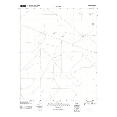
2010 Map of Yeso NW
USGS Topo · Published 2010About this map
Largo and its surrounding ranchlands define this high-desert portion of De Baca County as recorded in the early 21st century. The map illustrates a landscape shaped by water-sourcing infrastructure and cattle operations, featuring scattered family-held sites like Smith Ranch and Mccabe Ranch. A network of unpaved county roads, including County Rd-1-42 and County Rd-1-37, connects these isolated outposts across the arid terrain. Of particular interest to local historians are the numerous named water sources, such as Shorty Windmill, West Gillum Windmill, and the School Section Windmill, which signify the essential reliance on groundwater for sustaining the area's agricultural life. These landmarks represent the enduring ranching traditions of eastern New Mexico in a period where rural connectivity was defined by remote county tracks and namesake windmills.
Find a feature on this map
12 named features on this map. Tap any name to fly to it.
Don’t see what you’re looking for? This feature index may not catch every label — zoom into the map to look around manually.
Map Details
Editions of this 2010 Yeso NW Map
This is the sole edition of this map. No revisions or reprints were ever made.
Other maps of this area

1954 · Fort Sumner
USGS Topo · 1:250,000

1958 · Fort Sumner
USGS Topo · 1:250,000

1966 · El Morro Mesa
USGS Topo · 1:24,000

1966 · Borica SW
USGS Topo · 1:24,000

1966 · Cooper Ranch
USGS Topo · 1:24,000

1966 · Horney Ranch
USGS Topo · 1:24,000

1966 · Yeso
USGS Topo · 1:24,000

1966 · Yeso NW
USGS Topo · 1:24,000

1978 · El Morro Ranch SE
USGS Topo · 1:24,000

1979 · Fort Sumner
USGS Topo · 1:100,000