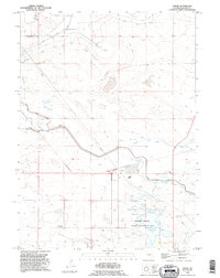
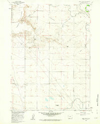
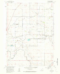
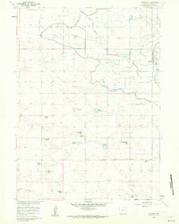
1990 Map of Yoder
USGS Topo · Published 1995About this map
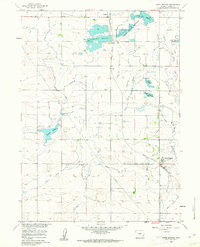
Yoder serves as the focal point of this landscape, situated in the heart of Goshen County’s agricultural and water-management system. The map reveals an intricate network of irrigation infrastructure essential to the high plains, including the Fort Laramie Canal and the Goshen Hole Main Ditch. These waterways, alongside Cherry Creek and Horse Creek, supported the ranching and farming operations that define the region’s history. To the south, the Springer Wildlife Habitat Management Area and the Goshen Hole Reservoir highlight the integration of conservation within this working landscape. Smaller sites of local interest include the Silver Tip settlement and the Greasewood Ranch, while a lone Cem stands as a quiet record of early residents. The presence of a Communication Tower Pumping Sta and various pipelines underscores the industrial modernization of the plains during the late twentieth century.
Find a feature on this map
19 named features on this map. Tap any name to fly to it.
Don’t see what you’re looking for? This feature index may not catch every label — zoom into the map to look around manually.
Map Details
Editions of this 1990 Yoder Map
This is the sole edition of this map. No revisions or reprints were ever made.
Other maps of this area

1896 · Patrick
USGS Topo · 1:125,000

1899 · Goshen Hole
USGS Topo · 1:125,000

1954 · Torrington
USGS Topo · 1:250,000

1954 · Cheyenne
USGS Topo · 1:250,000

1958 · Cheyenne
USGS Topo · 1:250,000

1958 · Torrington
USGS Topo · 1:250,000
1960 · Habig Spring
USGS Topo · 1:24,000
1960 · Huntley
USGS Topo · 1:24,000
1960 · Veteran
USGS Topo · 1:24,000
1960 · Hawk Springs
USGS Topo · 1:24,000