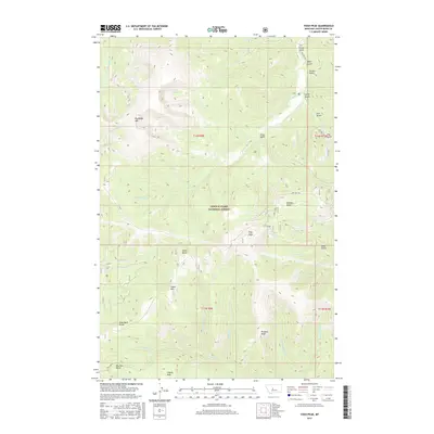
2017 Map of Yogo Peak
USGS Topo · Published 2017About this map
Lewis & Clark National Forest encompasses this high-altitude landscape, where the extraction of minerals and the movement of water define the local geography. Mining history is evident at the Canoy Mine and Finn Claims situated just east of Yogo Peak. These sites reflect the region's legacy of prospecting, nestled within a complex system of drainages such as Yogo Creek and Dry Wolf Creek. The terrain is characterized by prominent summits, including the massive Big Baldy Mountain and the distinct Tepee Butte, which provided natural landmarks for early travelers and forest rangers alike. High alpine water bodies like Rhoda Lake and Lake Elva sit tucked below these ridges, while the Dry Wolf Road provides the primary access through the drainage-carved gulches and valleys that dominate the eastern portion of the survey.
Find a feature on this map
41 named features on this map. Tap any name to fly to it.
Don’t see what you’re looking for? This feature index may not catch every label — zoom into the map to look around manually.
Map Details
Editions of this 2017 Yogo Peak Map
This is the sole edition of this map. No revisions or reprints were ever made.
Other maps of this area

1886 · Little Belt Mts.
USGS Topo · 1:250,000

1890 · Fort Benton
USGS Topo · 1:250,000

1892 · Fort Benton
USGS Topo · 1:250,000

1894 · Little Belt Mts.
USGS Topo · 1:250,000

1897 · Fort Benton
USGS Topo · 1:250,000

1897 · Little Belt Mts.
USGS Topo · 1:250,000

1898 · Little Belt Mts.
USGS Topo · 1:250,000

1902 · Little Belt Mts.
USGS Topo · 1:250,000

1948 · White Sulphur Springs
USGS Topo · 1:250,000

1954 · Great Falls
USGS Topo · 1:250,000