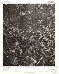
1975 Map of Yolande NW
USGS Topo · Published 1977About this map
The settlement of Oak Grove stands out against a landscape of extensive surface excavations and industrial land use in this late 1970s orthophotoquad. Produced through a collaboration between the Geological Survey and the Soil Conservation Service, this imagery reveals the complex topography of western Jefferson County. Unlike a traditional topographic sheet, this orthophoto provides a direct visual of the disturbed earth and terraced terrain characteristic of the region's mining operations, which define the local economy and geography. Narrow, winding roads trace the ridges between deep valleys, connecting small clearings and homesteads to the more established community at Oak Grove. The stark contrast between the dense wooded tracts and the geometric patterns of industrial sites offers a clear perspective on how large-scale extraction has shaped the physical layout of the area near the Warrior River basin.
Find a feature on this map
1 named feature on this map. Tap any name to fly to it.
Don’t see what you’re looking for? This feature index may not catch every label — zoom into the map to look around manually.
Map Details
Editions of this 1975 Yolande NW Map
This is the sole edition of this map. No revisions or reprints were ever made.
Other maps of this area

1893 · Jasper
USGS Topo · 1:125,000

1899 · Brookwood
USGS Topo · 1:125,000

1927 · Adger
USGS Topo · 1:48,000

1929 · Searles
USGS Topo · 1:48,000

1932 · Yolande
USGS Topo · 1:62,500

1934 · Searles
USGS Topo · 1:62,500

1935 · Port Birmingham
USGS Topo · 1:48,000

1935 · Yolande
USGS Topo · 1:62,500

1938 · Port Birmingham
USGS Topo · 1:62,500

1949 · Tutwiler School
USGS Topo · 1:24,000