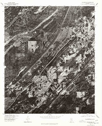
1975 Map of Yolande SE
USGS Topo · Published 1977About this map
Mc Calla and the surrounding Alabama countryside are captured here in mid-1970s detail through a high-altitude aerial orthophotograph. This specific map, produced by the Geological Survey in cooperation with the Soil Conservation Service, reveals a landscape defined by sharp geological ridges and early suburban expansion. The imagery highlights the cleared patches of land and the distinct path of major transportation routes cutting through the forested terrain near Baylor. By utilizing 1:80,000-scale aerial photography taken in late 1975, the map provides an exacting look at the physical layout of Kimbrell and its rural infrastructure. The orthophoto format allows for direct measurement between features, offering local historians a precise view of residential clusters and cleared fields before the significant development of the following decades changed the character of this Jefferson County area.
Find a feature on this map
3 named features on this map. Tap any name to fly to it.
Don’t see what you’re looking for? This feature index may not catch every label — zoom into the map to look around manually.
Map Details
Editions of this 1975 Yolande SE Map
This is the sole edition of this map. No revisions or reprints were ever made.
Other maps of this area

1890 · Bessemer
USGS Topo · 1:125,000

1892 · Bessemer
USGS Topo · 1:125,000

1899 · Brookwood
USGS Topo · 1:125,000

1905 · Bessemer Iron District
USGS Topo · 1:62,500

1907 · Bessemer Special
USGS Topo · 1:62,500

1910 · Montevallo
USGS Topo · 1:62,500

1927 · Adger
USGS Topo · 1:48,000

1932 · Yolande
USGS Topo · 1:62,500

1934 · Blocton
USGS Topo · 1:48,000

1935 · Yolande
USGS Topo · 1:62,500