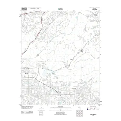
2012 Map of Yorba Linda
USGS Topo · Published 2012About this map
Carlton and the surrounding residential grids of Orange County define the southern half of this landscape, where suburban expansion meets the canyonlands. The terrain shifts abruptly north of Yorba Linda Blvd, giving way to a network of steep ridgelines and drainages including Tonner Canyon and Carbon Canyon. This topographic transition is marked by recreational and institutional landmarks such as the Firestone Scout Reservation and the North Orange County Community College campus.
Find a feature on this map
41 named features on this map. Tap any name to fly to it.
Don’t see what you’re looking for? This feature index may not catch every label — zoom into the map to look around manually.
Map Details
Editions of this 2012 Yorba Linda Map
This is the sole edition of this map. No revisions or reprints were ever made.
Other maps of this area

1894 · Pomona
USGS Topo · 1:62,500

1896 · Anaheim
USGS Topo · 1:62,500

1897 · Pomona
USGS Topo · 1:62,500

1897 · Cucamonga
USGS Topo · 1:62,500

1898 · Pomona
USGS Topo · 1:62,500

1898 · Anaheim
USGS Topo · 1:62,500

1900 · Cucamonga
USGS Topo · 1:62,500

1901 · Southern California Sheet No. 1
USGS Topo · 1:250,000

1901 · Anaheim
USGS Topo · 1:62,500

1902 · Corona
USGS Topo · 1:125,000