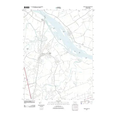
2010 Map of York Haven
USGS Topo · Published 2010About this map
York Haven Dam and the expansive Susquehanna River define the eastern edge of this landscape, where industrial infrastructure meets complex riverine islands. The townships of Manchester and Mount Wolf serve as the primary residential hubs, linked by a dense network of local roads including Mundis Race Rd and Jerusalem School Rd. The river itself is punctuated by significant landforms such as Brunner Island, Haldeman Island, and Ely Island, illustrating the braided nature of the waterway as it flows toward Schulls Rock.
Find a feature on this map
77 named features on this map. Tap any name to fly to it.
Don’t see what you’re looking for? This feature index may not catch every label — zoom into the map to look around manually.
Map Details
Editions of this 2010 York Haven Map
This is the sole edition of this map. No revisions or reprints were ever made.
Other maps of this area

1906 · New Cumberland
USGS Topo · 1:62,500

1908 · Middletown
USGS Topo · 1:62,500

1908 · York
USGS Topo · 1:62,500

1910 · York
USGS Topo · 1:62,500

1920 · Hanover
USGS Topo · 1:62,500

1922 · Hanover
USGS Topo · 1:62,500

1943 · New Cumberland
USGS Topo · 1:62,500

1943 · Middletown
USGS Topo · 1:62,500

1948 · Baltimore
USGS Topo · 1:250,000

1950 · Harrisburg
USGS Topo · 1:250,000