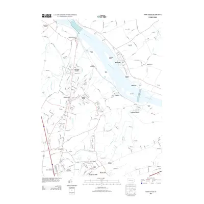
2013 Map of York Haven
USGS Topo · Published 2013About this map
Brunner Island and Haldeman Island dominate the wide stretch of the Susquehanna River as it passes through this portion of York and Lancaster counties. This 2013 survey documents the modern suburban and industrial landscape between Manchester and the river, featuring a high density of named neighborhoods such as Conewago Heights, Clear View, and North View Hills. The legacy of early Pennsylvania industry is preserved at Codorus Furnace along Codorus Creek, providing a sharp contrast to the nearby rail activity at Wago Junction. The geography of the river itself is detailed through natural landmarks like the Conewago Falls and Haldeman Riffles, while the upland terrain toward Mount Zion is defined by a mix of established agriculture, including the Moo - Daddy Dairy Farm, and the expanding residential footprints of Emigsville and Hayshire.
Find a feature on this map
240 named features on this map. Tap any name to fly to it.
Don’t see what you’re looking for? This feature index may not catch every label — zoom into the map to look around manually.
Map Details
Editions of this 2013 York Haven Map
This is the sole edition of this map. No revisions or reprints were ever made.
Other maps of this area

1906 · New Cumberland
USGS Topo · 1:62,500

1908 · Middletown
USGS Topo · 1:62,500

1908 · York
USGS Topo · 1:62,500

1910 · York
USGS Topo · 1:62,500

1920 · Hanover
USGS Topo · 1:62,500

1922 · Hanover
USGS Topo · 1:62,500

1943 · New Cumberland
USGS Topo · 1:62,500

1943 · Middletown
USGS Topo · 1:62,500

1948 · Baltimore
USGS Topo · 1:250,000

1950 · Harrisburg
USGS Topo · 1:250,000