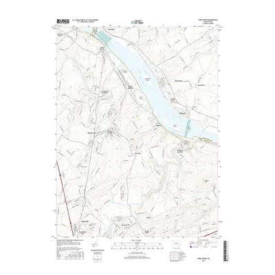
2016 Map of York Haven
USGS Topo · Published 2016About this map
The Susquehanna River dominates this landscape, serving as the historical and geographical boundary between York and Lancaster counties. Along its banks, the industrial and transport history of the region is evident at York Haven and Brunner Island, where the river's path is punctuated by numerous islands like Haldeman Island and Ely Island. The interior of York County reveals a dense network of established settlements, including the borough of Manchester and nearby Mount Wolf, which grew alongside the Norfolk Southern rail line passing through Wago Junction.
Find a feature on this map
56 named features on this map. Tap any name to fly to it.
Don’t see what you’re looking for? This feature index may not catch every label — zoom into the map to look around manually.
Map Details
Editions of this 2016 York Haven Map
This is the sole edition of this map. No revisions or reprints were ever made.
Other maps of this area

1906 · New Cumberland
USGS Topo · 1:62,500

1908 · Middletown
USGS Topo · 1:62,500

1908 · York
USGS Topo · 1:62,500

1910 · York
USGS Topo · 1:62,500

1920 · Hanover
USGS Topo · 1:62,500

1922 · Hanover
USGS Topo · 1:62,500

1943 · New Cumberland
USGS Topo · 1:62,500

1943 · Middletown
USGS Topo · 1:62,500

1948 · Baltimore
USGS Topo · 1:250,000

1950 · Harrisburg
USGS Topo · 1:250,000