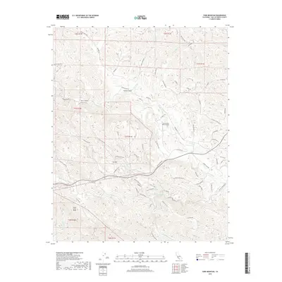
2018 Map of York Mountain
USGS Topo · Published 2018About this map
York Mountain stands as a central topographic prominence within the Santa Lucia Range on this modern survey of the Central Coast interior. The landscape is defined by its complex drainage network, where Summit Creek, Sheepcamp Creek, and Jack Creek carve through deeply etched canyons. This area of San Luis Obispo County exhibits a transition from wilder ridgelines to the structured agricultural and residential corridors along Vineyard Drive and York Mountain Road. The presence of the Oak Country Ranch Airport suggests the private aviation and large-acreage ranching culture that characterizes these highlands. Along the southern slopes, the headwaters of Santa Rita Creek and the South Fork Santa Rita Creek indicate the critical role this watershed plays for the lower valleys. The map also records numerous local access points like Dover Canyon Road and Niderer Road, tracing the persistent human footprint across Summit Canyon.
Find a feature on this map
67 named features on this map. Tap any name to fly to it.
Don’t see what you’re looking for? This feature index may not catch every label — zoom into the map to look around manually.
Map Details
Editions of this 2018 York Mountain Map
This is the sole edition of this map. No revisions or reprints were ever made.
Other maps of this area

1897 · San Luis Obispo
USGS Topo · 1:62,500

1897 · Cayucos
USGS Topo · 1:62,500

1900 · San Luis
USGS Topo · 1:125,000

1919 · Paso Robles
USGS Topo · 1:62,500

1919 · Adelaida
USGS Topo · 1:62,500

1932 · Adelaida
USGS Topo · 1:62,500

1937 · Cayucos
USGS Topo · 1:62,500

1942 · Adelaida
USGS Topo · 1:62,500

1942 · San Luis Obispo
USGS Topo · 1:62,500

1943 · Paso Robles
USGS Topo · 1:62,500