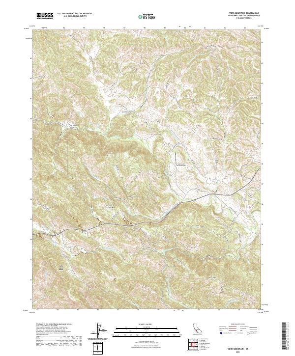
2021 Map of York Mountain
USGS Topo · Published 2021About this map
The Santa Lucia Range dominates this portion of San Luis Obispo County, where steep drainages and winding ridgelines define the landscape. Small settlements and points of interest such as York Mtn and Summit Canyon are situated among a complex network of seasonal watercourses, including Jack Cr, Willow Cr, and Paso Robles Cr. The road system, featuring named routes like Vineyard Dr and Dover Canyon Rd, follows the natural contours of the hills, reflecting the area's transition into a more developed ranching and viticultural corridor.
Find a feature on this map
75 named features on this map. Tap any name to fly to it.
Don’t see what you’re looking for? This feature index may not catch every label — zoom into the map to look around manually.
Map Details
Editions of this 2021 York Mountain Map
This is the sole edition of this map. No revisions or reprints were ever made.
Other maps of this area

1897 · San Luis Obispo
USGS Topo · 1:62,500

1897 · Cayucos
USGS Topo · 1:62,500

1900 · San Luis
USGS Topo · 1:125,000

1919 · Paso Robles
USGS Topo · 1:62,500

1919 · Adelaida
USGS Topo · 1:62,500

1932 · Adelaida
USGS Topo · 1:62,500

1937 · Cayucos
USGS Topo · 1:62,500

1942 · Adelaida
USGS Topo · 1:62,500

1942 · San Luis Obispo
USGS Topo · 1:62,500

1943 · Paso Robles
USGS Topo · 1:62,500