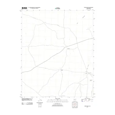
2010 Map of York Ranch
USGS Topo · Published 2010About this map
York Ranch serves as the focal point of this high-desert New Mexican landscape, situated at the intersection of critical ranching corridors. The area’s reliance on water infrastructure is evident through several distributed features such as Rock Tank Windmill and Sand Windmill, which support the livestock operations central to the region. To the northeast, the terrain is dominated by the volcanic features of The Malpais, while Goat Tank Canyon cuts through the topography to the east. Transportation and logistics are facilitated by a network of rural routes including SR 117 and Pie Town Rd, the latter suggesting a connection to the nearby community known for its frontier history. The presence of King Ranch Airport near the York Headquarters underscores the necessity of aerial access in this expansive cattle country.
Find a feature on this map
11 named features on this map. Tap any name to fly to it.
Don’t see what you’re looking for? This feature index may not catch every label — zoom into the map to look around manually.
Map Details
Editions of this 2010 York Ranch Map
This is the sole edition of this map. No revisions or reprints were ever made.
Other maps of this area

1917 · Broom Mountain
USGS Topo · 1:125,000

1954 · Saint Johns
USGS Topo · 1:250,000

1954 · Socorro
USGS Topo · 1:250,000

1957 · Saint Johns
USGS Topo · 1:250,000

1958 · Socorro
USGS Topo · 1:250,000

1958 · Saint Johns
USGS Topo · 1:250,000
1961 · North Pasture
USGS Topo · 1:24,000

1962 · Socorro
USGS Topo · 1:250,000

1962 · Saint Johns
USGS Topo · 1:250,000
1964 · Sand Canyon
USGS Topo · 1:24,000