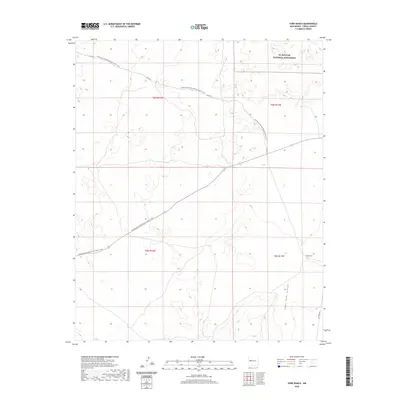
2020 Map of York Ranch
USGS Topo · Published 2020About this map
York Ranch anchors the southeastern corner of this high-altitude landscape in New Mexico's Cibola County. The map is defined by the expansive El Malpais National Monument, which occupies the northeastern reaches, protecting a terrain shaped by ancient volcanic activity. Cutting across the center of the sheet from northwest to southeast, the Continental Divide National Scenic Trail traces a path through the high desert, crossing Co Rd 42 and the local highway. This modern survey reflects the enduring cattle ranching heritage of the region, where family-named landmarks like Goat Tank Canyon signify the essential relationship between the land and its limited water resources. The convergence of Pie Town Rd and the National Scenic Trail illustrates how historic ranching routes have evolved into modern corridors for both commerce and recreation.
Find a feature on this map
10 named features on this map. Tap any name to fly to it.
Don’t see what you’re looking for? This feature index may not catch every label — zoom into the map to look around manually.
Map Details
Editions of this 2020 York Ranch Map
This is the sole edition of this map. No revisions or reprints were ever made.
Other maps of this area

1917 · Broom Mountain
USGS Topo · 1:125,000

1954 · Saint Johns
USGS Topo · 1:250,000

1954 · Socorro
USGS Topo · 1:250,000

1957 · Saint Johns
USGS Topo · 1:250,000

1958 · Socorro
USGS Topo · 1:250,000

1958 · Saint Johns
USGS Topo · 1:250,000
1961 · North Pasture
USGS Topo · 1:24,000

1962 · Socorro
USGS Topo · 1:250,000

1962 · Saint Johns
USGS Topo · 1:250,000
1964 · Sand Canyon
USGS Topo · 1:24,000