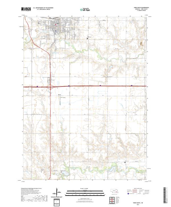
2021 Map of York South
USGS Topo · Published 2021About this map
The York municipal center and the surrounding agricultural landscape of York County are detailed in this modern survey. The map centers on the grid-patterned streets south of the York County Courthouse, extending past York College toward the southern prairies. This area illustrates the transition from a consolidated town center into a landscape dominated by section-line roads and riparian corridors. Waterways such as Beaver Creek and the West Fork Big Blue River carve through the terrain, supporting local reservoirs like Woehner Reservoir and smaller bodies like Sacks Lake.
Find a feature on this map
55 named features on this map. Tap any name to fly to it.
Don’t see what you’re looking for? This feature index may not catch every label — zoom into the map to look around manually.
Map Details
Editions of this 2021 York South Map
This is the sole edition of this map. No revisions or reprints were ever made.
Other maps of this area

1898 · York
USGS Topo · 1:125,000

1899 · York
USGS Topo · 1:125,000

1934 · Utica
USGS Topo · 1:62,500

1937 · Utica
USGS Topo · 1:62,500

1955 · Lincoln
USGS Topo · 1:250,000

1957 · Lincoln
USGS Topo · 1:250,000

1958 · Lincoln
USGS Topo · 1:250,000
1969 · York North
USGS Topo · 1:24,000
1969 · Utica SW
USGS Topo · 1:24,000

1969 · Fairmont
USGS Topo · 1:24,000