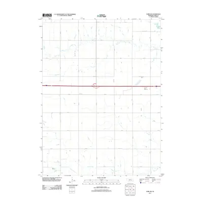
2011 Map of York SW
USGS Topo · Published 2011About this map
Buller Cemetery stands as a quiet landmark in the southwestern portion of this Nebraska landscape, situated near the headwaters of Galaway Creek. The terrain is defined by a series of south-flowing drainage systems, including Beaver Creek and Bear Creek, which cut across a grid of section roads. In the northeast, Recharge Lake serves as a modern water feature, contrasting with the traditional agricultural land divisions typical of York County. The east-west corridor of Interstate 80 bisects the quadrangle, featuring the York Rest Area - Eastbound. This survey documents a transition in the rural environment where long-standing family and community sites like the cemetery remain preserved alongside major 20th-century transportation infrastructure and water management projects.
Find a feature on this map
24 named features on this map. Tap any name to fly to it.
Don’t see what you’re looking for? This feature index may not catch every label — zoom into the map to look around manually.
Map Details
Editions of this 2011 York SW Map
This is the sole edition of this map. No revisions or reprints were ever made.
Other maps of this area

1898 · York
USGS Topo · 1:125,000

1899 · York
USGS Topo · 1:125,000

1955 · Lincoln
USGS Topo · 1:250,000

1957 · Lincoln
USGS Topo · 1:250,000

1958 · Lincoln
USGS Topo · 1:250,000
1968 · Henderson NE
USGS Topo · 1:24,000
1968 · Henderson
USGS Topo · 1:24,000

1969 · Bixby
USGS Topo · 1:24,000
1969 · York North
USGS Topo · 1:24,000

1969 · Fairmont
USGS Topo · 1:24,000