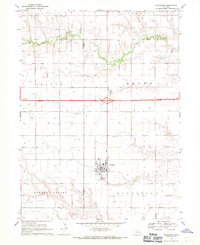
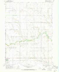
1968 Map of Henderson
USGS Topo · Published 1971About this map
The town of Henderson serves as the central hub of this agricultural landscape in the late 1960s, surrounded by a distinct concentration of religious and family-linked burial grounds. The mapping of the Mennonite Cem, Bethesda Cem, Friesen Cem, and Ebenezer Cem reflects the area's deep-rooted denominational heritage and settlement patterns. The terrain is defined by the gentle drainage of Beaver Creek and the broad reaches of Farmers Valley.
Find a feature on this map
22 named features on this map. Tap any name to fly to it.
Don’t see what you’re looking for? This feature index may not catch every label — zoom into the map to look around manually.
Map Details
Editions of this 1968 Henderson Map
This is the sole edition of this map. No revisions or reprints were ever made.
Other maps of this area

1898 · York
USGS Topo · 1:125,000

1899 · York
USGS Topo · 1:125,000

1955 · Lincoln
USGS Topo · 1:250,000

1957 · Lincoln
USGS Topo · 1:250,000

1958 · Lincoln
USGS Topo · 1:250,000
1968 · Aurora East
USGS Topo · 1:24,000
1968 · Hampton
USGS Topo · 1:24,000
1968 · Henderson NE
USGS Topo · 1:24,000

1969 · Bixby
USGS Topo · 1:24,000
1969 · Bradshaw
USGS Topo · 1:24,000