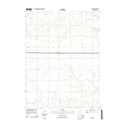
2014 Map of York SW
USGS Topo · Published 2014About this map
Buller Cem sits alone in the southwestern corner of this landscape, a small but vital anchor for local family historians. The terrain is defined by a dense grid of rural corridors, from Road 5 in the south to Road 13 at the northern edge, which navigate the gentle drainage basins of Beaver Cr, Bear Cr, and Galaway Cr. The hydrology is primarily composed of these meandering creeks that feed into the larger prairie system, though Recharge Lake in the northeast corner introduces a significant man-made water feature to the local environment. Modern transportation infrastructure is prominent, with the east-west passage of Interstate 80 cutting through the center and intersecting with the Ne-93e-Link, illustrating the area's role as a transit corridor within the agricultural heartland.
Find a feature on this map
24 named features on this map. Tap any name to fly to it.
Don’t see what you’re looking for? This feature index may not catch every label — zoom into the map to look around manually.
Map Details
Editions of this 2014 York SW Map
This is the sole edition of this map. No revisions or reprints were ever made.
Other maps of this area

1898 · York
USGS Topo · 1:125,000

1899 · York
USGS Topo · 1:125,000

1955 · Lincoln
USGS Topo · 1:250,000

1957 · Lincoln
USGS Topo · 1:250,000

1958 · Lincoln
USGS Topo · 1:250,000
1968 · Henderson NE
USGS Topo · 1:24,000
1968 · Henderson
USGS Topo · 1:24,000

1969 · Bixby
USGS Topo · 1:24,000
1969 · York North
USGS Topo · 1:24,000

1969 · Fairmont
USGS Topo · 1:24,000