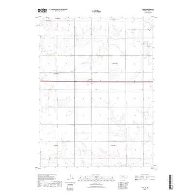
2017 Map of York SW
USGS Topo · Published 2017About this map
Recharge Lake sits in the northeast corner of this agricultural landscape in York County, where the regular grid of section lines and country roads reveals a deeply established farming economy. The terrain is defined by the subtle drainages of Beaver Cr, Bear Cr, and Galaway Cr, which break the geometric uniformity of the township and range system. A quiet marker of the area's pioneer history is found at Buller Cem in the southwestern portion of the sheet. The survey illustrates the intersection of modern infrastructure and rural tradition, showing how interstate transit and local connectors traverse the traditional land divisions of t10n r3w and surrounding townships.
Find a feature on this map
7 named features on this map. Tap any name to fly to it.
Don’t see what you’re looking for? This feature index may not catch every label — zoom into the map to look around manually.
Map Details
Editions of this 2017 York SW Map
This is the sole edition of this map. No revisions or reprints were ever made.
Other maps of this area

1898 · York
USGS Topo · 1:125,000

1899 · York
USGS Topo · 1:125,000

1955 · Lincoln
USGS Topo · 1:250,000

1957 · Lincoln
USGS Topo · 1:250,000

1958 · Lincoln
USGS Topo · 1:250,000
1968 · Henderson NE
USGS Topo · 1:24,000
1968 · Henderson
USGS Topo · 1:24,000

1969 · Bixby
USGS Topo · 1:24,000
1969 · York North
USGS Topo · 1:24,000

1969 · Fairmont
USGS Topo · 1:24,000