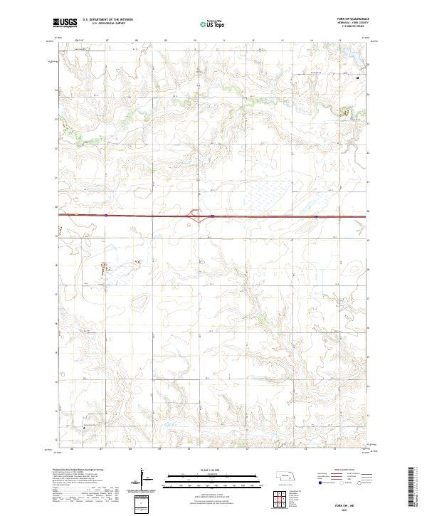
2021 Map of York SW
USGS Topo · Published 2021About this map
Mennonite Cem sits in the southwestern portion of this York County landscape, marking a site of local genealogical interest amidst the rectilinear grid of Nebraska farmland. This 2021 survey illustrates a region defined by agricultural organization and the natural drainage patterns of several local waterways. The terrain is bisected by the east-west flow of Beaver Cr in the north and Galaway Cr in the south, with the smaller Bear Cr branch winding through the central sections. The map records a dense network of rural infrastructure, from primary thoroughfares like Bradshaw Rd and Recharge Rd to the numbered secondary roads that delineate the townships. These features together show a highly structured prairie environment where water resources and section-line roads dictate the layout of modern land use and historical settlement.
Find a feature on this map
22 named features on this map. Tap any name to fly to it.
Don’t see what you’re looking for? This feature index may not catch every label — zoom into the map to look around manually.
Map Details
Editions of this 2021 York SW Map
This is the sole edition of this map. No revisions or reprints were ever made.
Other maps of this area

1898 · York
USGS Topo · 1:125,000

1899 · York
USGS Topo · 1:125,000

1955 · Lincoln
USGS Topo · 1:250,000

1957 · Lincoln
USGS Topo · 1:250,000

1958 · Lincoln
USGS Topo · 1:250,000
1968 · Henderson NE
USGS Topo · 1:24,000
1968 · Henderson
USGS Topo · 1:24,000

1969 · Bixby
USGS Topo · 1:24,000
1969 · York North
USGS Topo · 1:24,000

1969 · Fairmont
USGS Topo · 1:24,000