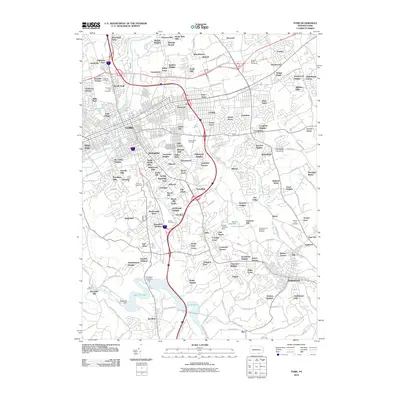
2010 Map of York
USGS Topo · Published 2010About this map
Codorus Creek and its many branches shape the landscape of this southern Pennsylvania region, winding through a densely settled suburban and industrial corridor. The area is defined by a deep history of land use, evidenced by numerous burial grounds including Lebanon Cemetery, Prospect Hill Cemetery, and the Strickler-Miller Cemetery. Infrastructure projects are prominent, notably the York Water Company Dam and the sprawling reservoirs of Lake Williams and Lake Redman to the south. Residential development is highly granular, with dozens of named tracts and subdivisions such as Lightners Gwendale Tract, Pleasureville, and Spring Plains filling the spaces between major transit routes. Educational and recreational landmarks are scattered throughout, from the Pennsylvania State University - York Campus to the Rolling Acres Pitch and Putt Golf Course, reflecting the diverse character of the city's periphery in the early 21st century.
Find a feature on this map
187 named features on this map. Tap any name to fly to it.
Don’t see what you’re looking for? This feature index may not catch every label — zoom into the map to look around manually.
Map Details
Editions of this 2010 York Map
This is the sole edition of this map. No revisions or reprints were ever made.
Other maps of this area

1906 · New Cumberland
USGS Topo · 1:62,500

1908 · Middletown
USGS Topo · 1:62,500

1908 · York
USGS Topo · 1:62,500

1910 · York
USGS Topo · 1:62,500

1920 · Hanover
USGS Topo · 1:62,500

1922 · Hanover
USGS Topo · 1:62,500

1943 · New Cumberland
USGS Topo · 1:62,500

1943 · Middletown
USGS Topo · 1:62,500

1948 · Baltimore
USGS Topo · 1:250,000

1950 · Harrisburg
USGS Topo · 1:250,000