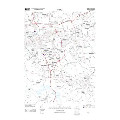
2013 Map of York
USGS Topo · Published 2013About this map
Codorus Cr and its tributaries carve through this landscape just east of the city, defining the residential development of the early 21st century. The map shows a transition from the dense suburban clusters of Pleasureville and Stonybrook to the protected waters of the York Reservoir and Lake Redman in the south. These reservoirs, along with Mill Cr and Inners Cr, shape the growth of neighborhoods like Wilshire Hills and Leafydale Terrace. The dense network of state routes, including Pa-462 and Pa-24, illustrates the modern connectivity between established settlements and newer developments such as Stonewood Farms and Kalreda Woods. This era reflects a landscape dominated by residential expansion, where local geography is tied to both the historical flow of the creek and the mid-century infrastructure of the I-83 corridor.
Find a feature on this map
124 named features on this map. Tap any name to fly to it.
Don’t see what you’re looking for? This feature index may not catch every label — zoom into the map to look around manually.
Map Details
Editions of this 2013 York Map
This is the sole edition of this map. No revisions or reprints were ever made.
Other maps of this area

1906 · New Cumberland
USGS Topo · 1:62,500

1908 · Middletown
USGS Topo · 1:62,500

1908 · York
USGS Topo · 1:62,500

1910 · York
USGS Topo · 1:62,500

1920 · Hanover
USGS Topo · 1:62,500

1922 · Hanover
USGS Topo · 1:62,500

1943 · New Cumberland
USGS Topo · 1:62,500

1943 · Middletown
USGS Topo · 1:62,500

1948 · Baltimore
USGS Topo · 1:250,000

1950 · Harrisburg
USGS Topo · 1:250,000