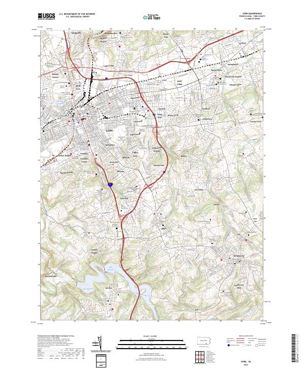
2023 Map of York
USGS Topo · Published 2023About this map
York acts as the dense urban hub of this 2023 survey, surrounded by a ring of residential developments like Fireside Terrace, Grantley, and Stonybrook Heights. The city's deep religious and civic roots are visible in the high density of historic interment sites near the center, including Prospect Hill Cem, Lebanon Cem, and the York City Burial Grounds. This pattern of concentrated burial sites, often associated with specific congregations such as the Saint Johns Episcopal Churchyard and First Presbyterian Churchyard, provides an exceptional resource for tracing family lineage through the city’s early established wards.
Find a feature on this map
118 named features on this map. Tap any name to fly to it.
Don’t see what you’re looking for? This feature index may not catch every label — zoom into the map to look around manually.
Map Details
Editions of this 2023 York Map
This is the sole edition of this map. No revisions or reprints were ever made.
Other maps of this area

1906 · New Cumberland
USGS Topo · 1:62,500

1908 · Middletown
USGS Topo · 1:62,500

1908 · York
USGS Topo · 1:62,500

1910 · York
USGS Topo · 1:62,500

1920 · Hanover
USGS Topo · 1:62,500

1922 · Hanover
USGS Topo · 1:62,500

1943 · New Cumberland
USGS Topo · 1:62,500
1943 · Middletown
USGS Topo · 1:62,500
1948 · Baltimore
USGS Topo · 1:250,000

1950 · Harrisburg
USGS Topo · 1:250,000