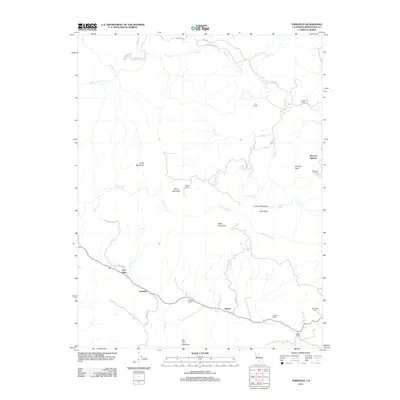
2012 Map of Yorkville
USGS Topo · Published 2012About this map
Yorkville and Ingram anchor the lower section of this 2012 survey, revealing a landscape defined by traditional ranching and the winding course of Dry Cr. The map illustrates a long-standing pattern of land use in southern Mendocino County, where named estates like Pershaver Ranch, Carlson Ranch, and Haehl Ranch occupy the lowlands between significant peaks. Water sources are vital here, with features like Duncan Springs, Pregnant Spring, and Hilltop Spring distributed across the high ground. The terrain is marked by a series of prominent summits including Sanel Mountain, Snow Mountain, and Lookout Mountain, which overlook the creek drainages of Feliz Cr and Cummiskey Cr. These natural boundaries and the network of rural routes, such as Yorkville Ranch Rd and Elkhorn Rd, delineate the boundaries of this agricultural and wilderness interface.
Find a feature on this map
40 named features on this map. Tap any name to fly to it.
Don’t see what you’re looking for? This feature index may not catch every label — zoom into the map to look around manually.
Map Details
Editions of this 2012 Yorkville Map
This is the sole edition of this map. No revisions or reprints were ever made.
Other maps of this area

1920 · Ukiah
USGS Topo · 1:62,500

1938 · Hopland
USGS Topo · 1:62,500

1943 · Boonville
USGS Topo · 1:62,500

1943 · Hopland
USGS Topo · 1:62,500

1943 · Ornbaun
USGS Topo · 1:62,500

1944 · Ukiah
USGS Topo · 1:62,500

1944 · Ornbaun
USGS Topo · 1:62,500

1944 · Hopland
USGS Topo · 1:62,500

1947 · Santa Rosa
USGS Topo · 1:250,000

1949 · Santa Rosa
USGS Topo · 1:250,000