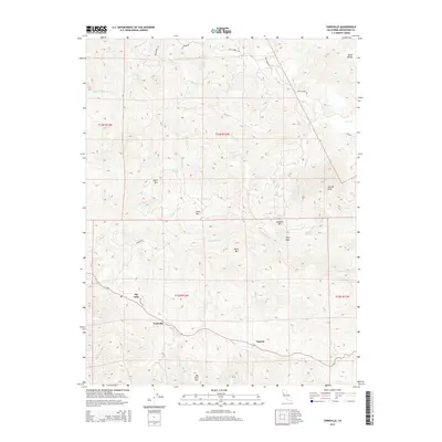
2015 Map of Yorkville
USGS Topo · Published 2015About this map
The settlement of Yorkville sits along the banks of Dry Cr in this southern Mendocino County landscape, where the Anderson Valley's mountainous terrain begins to rise. A network of narrow canyon roads like Feliz Creek Rd and Hulbert Rd connect small communities including Ingram and The Oaks, illustrating the rural settlement patterns typical of this region. The map captures a high-relief environment defined by prominent summits such as Snow Mtn, Sanel Mtn, and the distinctive Big Foot Mtn. These peaks divide the various watersheds, with numerous waterways like Feliz Cr and Elkhorn Cr cutting deep into the hills. In the northeast, the Sanel Valley offers a rare stretch of level ground among the ridges. Water sources are marked specifically, including the curiously named Pregnant Spring and Saddle Spring, which were vital markers for livestock and local travel.
Find a feature on this map
32 named features on this map. Tap any name to fly to it.
Don’t see what you’re looking for? This feature index may not catch every label — zoom into the map to look around manually.
Map Details
Editions of this 2015 Yorkville Map
This is the sole edition of this map. No revisions or reprints were ever made.
Other maps of this area

1920 · Ukiah
USGS Topo · 1:62,500

1938 · Hopland
USGS Topo · 1:62,500

1943 · Boonville
USGS Topo · 1:62,500

1943 · Hopland
USGS Topo · 1:62,500

1943 · Ornbaun
USGS Topo · 1:62,500

1944 · Ukiah
USGS Topo · 1:62,500

1944 · Ornbaun
USGS Topo · 1:62,500

1944 · Hopland
USGS Topo · 1:62,500

1947 · Santa Rosa
USGS Topo · 1:250,000

1949 · Santa Rosa
USGS Topo · 1:250,000